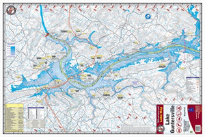
Kingfisher Lake Map Lewis Smith
$9.26
$10.37
(You save
$1.11
)
The Kingfisher Lake Map for Lewis Smith is an essential navigation tool for anglers, paddlers, and outdoor enthusiasts planning a trip to Lewis Smith Lake. Whether you're targeting smallmouth bass, crappie, or walleye, or simply exploring Alabama's scenic waterways, a detailed lake map keeps you oriented and helps you locate productive structure, depth changes, and access points.
This map is built for the water. Lake maps like this one give you a bird's-eye view of bottom contours, marked channels, boat launch locations, and notable landmarks—information that's hard to piece together on the fly. Whether you're new to the lake or a repeat visitor, having the geography locked in lets you fish smarter and spend less time guessing.
Kingfisher maps are a trusted choice among serious anglers across the Southeast. Keep one in your tackle bag, boat, or truck bed for quick reference before launch or to plan your next outing.
What's Included
- Kingfisher Lake Map for Lewis Smith Lake
Frequently Asked Questions
What lakes does Kingfisher make maps for?
Kingfisher produces detailed maps for lakes across the United States. This particular map covers Lewis Smith Lake in Alabama. Check Kingfisher's catalog to see maps available for other waters you fish.
Can I use this map for boating and fishing?
Yes. Lake maps like this one are designed for anglers, boaters, and paddlers—anyone who needs navigation detail and bottom-structure information for safer, more effective time on the water.
Is this map waterproof?
We don't have specific material details for this map. We recommend checking with Kingfisher directly or storing your map in a waterproof bag or case if you'll be using it regularly on the water.