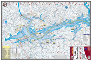
Kingfisher Lake Map Pickwick
$9.26
$10.37
(You save
$1.11
)
The Kingfisher Lake Map Pickwick is a detailed waterway chart designed for anglers, boaters, and water-sports enthusiasts who fish or explore the Pickwick Lake area. Whether you're planning a guided trip, scouting new fishing grounds, or navigating unfamiliar waters, a quality lake map is an essential tool that keeps you oriented and helps you identify promising structure, depth changes, and access points that you might miss from the water alone.
Kingfisher maps are trusted by serious anglers and recreational boaters throughout the South. This Pickwick Lake map provides the reference detail you need to fish more confidently and move safely across the water, particularly if you're new to the lake or chasing different seasons and conditions.
Keep a copy in your tackle bag, truck, or boat for quick reference before and during your trip. Waterway maps like this one are invaluable for trip planning, understanding lake layout, and sharing navigation details with fishing partners.
Frequently Asked Questions
What lake does this map cover?
This is a Kingfisher map of Pickwick Lake.
Who should use a lake map like this?
Anglers, boaters, kayakers, and anyone spending time on Pickwick Lake will benefit from having a detailed reference map. It's especially useful if you're new to the lake, planning a trip, or looking to explore new areas and structure.
How durable are Kingfisher maps?
We don't have specific durability details for this product. Check the product packaging or contact us if you have questions about material and weather resistance.